Munnar is located at the Idukki district of Kerala State in South India.
Munnar's mesmerising greenery, mountain scenery, calmness and cool refreshing air attracts honeymooners and tourists throughout the year. It is a weekend hideout location for domestic tourists during summer season. Foreign travellers likes watching the natural beauty of Kerala while the journey from Thekkady to Munnar.
Munnar is at the confluence of three rivers. In Tamil, the word 'munnu' means "three" and 'aar' means "river". Hence "Munnar" is a shortened version of 'Munnu Aar'. The 3 mountain streams joining together here are Madurapuzha, Nallathanni and Kundala. |
| Mattupetty Dam |
The tea estates, hills, lakes and forests inside Munnar area exposes it's beauty. The tea plants covered Munnar hills makes the feeling of seeing a wide green carpet.
Munnar Basic Facts:
 |
| Tea Plantations |
Location: 135 Km from Kochi
Altitude: Approximately 1600 meters
Nearest Airport: Cochin
Nearest Railway Station: Aluva
STD Code: 04865
Main Attraction: Exploration of hills around Munnar
Historical Importance: During British reign, Munnar was the summer resort of Government officials

Best Time to Visit Munnar:
The local people here speaks Malayalam (the official language of Kerala) and Tamil (the official language of Tamil Nadu). English is taught in schools from the primary level and even common people can read and speak English.
REACHING THERE
Towards Mattuppetty
To Eat and Stay:For vegetarians I recommend Saravana Bhavan which is well within the city and serves tasty food. South Indian food is very good and north Indian food requires an improvement. There are lot of hotels for accommodation. Its better to hire a cab for sight seeing.
 |
| Hydel Park |
 |
| Eravikulam |
 |
| Tea Plantations |
 |
| Tea Plantation |
- From Kochi: Munnar is 130 km (3.5 hr) from Kochi. The road is blind in some places and there are a lot of trucks and buses that seem to drive as if they own the road. Although the road is smooth (NH 49), it is narrow, twisty and curvy. Kothamangalam is on the way and is 80 km away from Munnar. Between Kothamangalam and next town "Adimali", you can experience a beautiful cool drive through a natural forest. Alongside, you can see many refreshing waterfalls. Once you reach Adimali, Munnar is just 30 kilometers away - but it will take almost an hour to reach. This is the last place where you can spot a decent restaurant before Munnar. Around 22 km from Adimali, you can start seeing the tea plantations on both sides of the road and a panoramic view of the western ghats. The view is extremely beautiful during the early mornings.
- From Aluva: Aluva is nearly 110 km from Munnar. Just outside Aluva railway station you can hire a taxi for Munnar for Rs 2000. There is a bus stand nearby as well which operates frequent buses to Munnar; ticket prices start from Rs 70 per person.
- From Madurai: Munnar is about 135 km from Madurai and 80 km from Theni. Madurai- Theni - Bodi - BodiMettu-Devikulam - Munnar route is the most scenic route by National Highway 49(Via Madurai-Cochin HighWay).
- From Coimbatore: Munnar is about 160 km from Coimbatore and 120 km from Pollachi. Coimbatore- Pollachi - Udumalpet - Chinnar - Marayoor - Munnar route is the most scenic route and though it will take bit longer, it is generally considered worth the extra time spent.
- From Kodaikanal: Kodaikanal is nearly 170 km from Munnar. Kodaikanal - Perumal Malai - Mayiladum Parai - Mooliyaru - Oothu - Falls View - Ganguvarpetty - Ghat Road - Periya Kulam - Theni - Bodi - Bodimettu - Devikulam - Munnar. This route is also scenic.
ATTRACTIONS:
Near Munnar Town
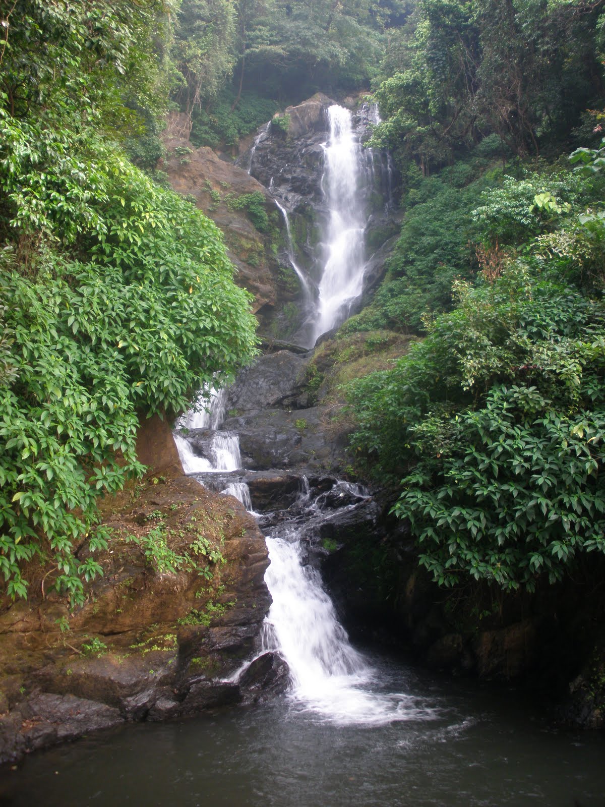
- Atukkad Waterfalls, A scenic waterfalls amidst hills and jungles. You can find a road leading to Atukkad Waterfalls on Kochi road (just about 5 km from Munnar). This road is very narrow and needs a lot of experience to drive on.
- Chithirapuram is located at a distance of around 10 km from Munnar. Chithirapuram has old playgrounds and courts, bungalows and sleepy little cottages which all give this place an old world charm. This town is also famous for its tea plantations in the world.
- Blossom Park, also known as Hydel Park, (1 km from Munnar).
- Pothamedu View Point
Towards Mattuppetty
- Floriculture Centre, run by the Kerala Forest Development Corporation. An extremely well-kept garden with a large variety of flowers and some herbal/ foliage plants, all against the backdrop of the tea plantations. Definitely worth a visit.
- Photo Point, (2 km from Munnar). It is a small place filled with woods and a small stream. Good location to take photos.
- Mattupetti Dam, (10 km from Munnar), this popular picnic spot activities like boating and horse riding and is a great place to spend the day e specially if visiting with children. You could take the speed boat ride which is fantastic. It costs Rs 300 if you have to hire a boat for you alone. The ride is for 15 min. The maximum capacity is 5 persons and you could save some money if you are a group of 4-5.
- Mattupetti Indo-Swiss Farm, Better known as Mattupetti (cattle village), Tamil migrant labourers had once upon a time reared cattle here. The cool climate and abundance of fodder made it the ideal location for the Indo-Swiss dairy farm. Established in 1961, the Kerala Livestock Development Board (KLDB) manages this highly specialised dairy farm. The dairy farm is a unique one of its kind with more than 100 varieties of high-yielding cattle being reared. Tourists are not allowed to enter the farm.
- Echo Point, (15 km from Munnar), on the way to top station from Munnar is a small lake set amidst rolling hills. Every loud call made from a spot on the lake embankment is returned manifold by the echo from the surrounding hills. Young tourists throng to this place to listen to the echoes of their friendship calls.
- Elephant Arrival Spot, (18 km from Munnar), Here you can board an elephant for a ride. It costs approximately Rs 350 per person.
- Kundala Lake, (23 km from Munnar). This lake is very beautiful amidst lush jungles. Hiring a pedal boat and exploring the lake and its surroundings is an awesome experience. Except at the place you hired the boat, don't expect to find humans around the lake as it is surrounded by scenic jungles and hills. Unless you know how to row a boat, prefer a pedal boat, each trip lasts around 30 min and will be closed at 4:30PM
- Top Station, (37 km from Munnar on the Kerala and Tamil Nadu border). Great views of the Western Ghats. Top station is the "top"-tourist attraction. This place gives a real 'above the clouds' experience. Regular buses go to Top Station (1 hr) from Munnar. A jeep costs Rs 400. The area is known for the Neelakurunji plant, which flowers only once every 12 years. The flower is violet.
Towards Marayoor
- Tata Tea Museum, also known as the KDHP Tea Museum, (Around 2 km on the Nallathany road, from Munnar). A must-see. Tourists can see a collection of odd bits from the colonial era. Photography is allowed on payment of Rs. 20; videography is strictly prohibited here. A very interesting 30-minute film is screened, and visitors are then taken around the factory to understand how tea is processed. This museum remains open from 10AM-4PM every day, closed on Mon. There is a Rs. 75 ticket fee for adults; lower for children.
- Naimakkadu Water Falls
- Eravikulam (Rajamalai) National Park, (45 min from Munnar). See Nilgiri Thar (Hemitragas hylocres) - an endangered species of mountain goats, rolling grasslands and sholas, spread over 97² km in the Rajamalai hills, rare flora and fauna, Atlas moth (largest in the world), lion-tailed macaque, leopards, tigers, The Kurichi or Neelakurinji Flowers turn the hills of Rajamalai blue every 12 years. The next bloom will be in 2018. One can actually debate if going to the high peak just to see some goats is worth all the effort or not. However, the walk along the park is very romantic and has some breath taking view. Please be aware that this park remains closed every year around February-March due to the breeding program of the Nilgiri Thar. Before visiting Munnar please check if the park is open or not. Tickets can be bought from the counter for INR 55 per adult. Please be warned that if you do not reach the counter before 8:30 AM, the queue can get so long that it may take a couple of hours to get the tickets. The visit to the park is arranged by buses. While coming back after the visit, you'd again have to wait in queue. The entire process of buying tickets, visiting park and coming back may take 4-5 hours.
- Anamudi Peak inside Eravikulam National Park, The highest peak (2,695 m) south of the Himalayas, towers over the sanctuary in majestic pride. The slopes of the hills abound in all kinds of rare flora and fauna. The Atlas moth, the largest of its kind in the world, is a unique inhabitant of the park. Other rare species of fauna found here are the Nilgiri Langur, the lion-tailed macaque, leopards, tigers. An ideal place for trekking, facilities are provided here and tourists are allowed to go on foot up to 2 kms from Anamudi. Going up to the peak is no longer permissible unless you have special permissions from forest department.
- Lakkam Water Falls. (24 km from Munnar). A small waterfall.
- Marayoor - (Around 40 km from Munnar). It is the only place in Kerala with natural growth of sandalwood trees, natural caves with murals, and relics from late Stone Age civilisation. There is a sandalwood factory of the Forestry department of Kerala and a children's park extending across one hectare of land under the canopy of a single Banyan tree, all of which attract tourists in large numbers.
- Chinnar Wildlife Sanctuary.Chinnar wildlife sanctuary is in the Western Ghats of Kerala. This wildlife sanctuary has a large number of plants and animals. This wildlife sanctuary is spread in around 90² km of area. This sanctuary is one of the protected areas in the western ghats because of the significance of its flora, geomorphologic features, ecology and local cultural.
To Eat and Stay:For vegetarians I recommend Saravana Bhavan which is well within the city and serves tasty food. South Indian food is very good and north Indian food requires an improvement. There are lot of hotels for accommodation. Its better to hire a cab for sight seeing.
 |
| Munnar-Thekkady Road |