Saturday 29 December 2012

Himavad Gopalaswamy Hill

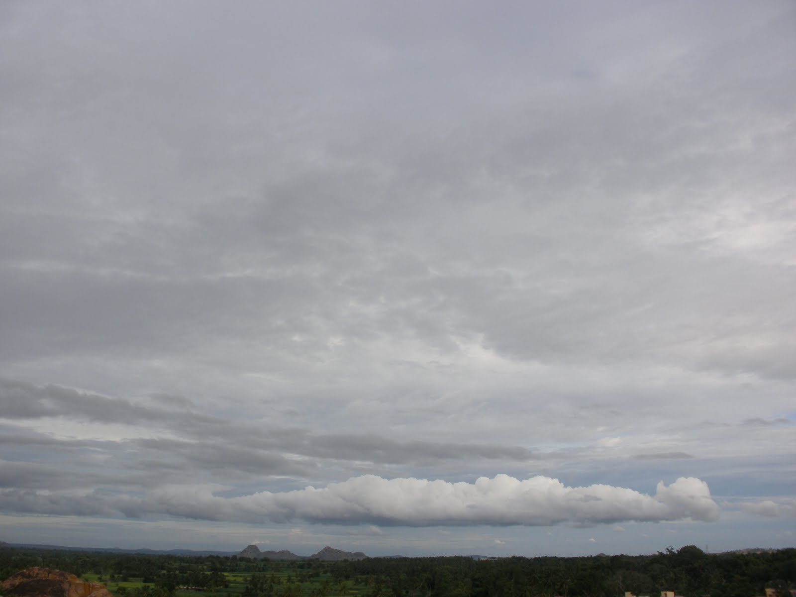
Himavad Gopalaswamy Betta, is a hill (betta in Kannada) located in the Chamarajanagar district of the state of Karnataka,at a height of 1450m and is extensively wooded. It is also the highest peak in the Bandipur National Park. It lies in the core area of the Bandipur National Park and is frequented by wild life including elephants. Dense fog predominates and covers the hills round the year and thus gets the prefix Himavad(in the native language of Kannada) and the temple of Venugopalaswamy (Lord Krishna) gives the full name of Himavad Gopalaswamy Betta


It is approximately 220 km from Bangalore and 75 km from Mysore on the Mysore Ooty road -10 km away from Gundlupet, which is 60 km away from Mysore. There is a motorable road all the way to the top of the hill. Entry fee is collected at the forest department check post at foot of the hill. Materials used for pooja (prayers) alone such as flowers, fruits, Incense sticks etc. are permitted. Other food items are not permitted to be carried in. All these materials should be carried in non-plastic bags. Entry fee has been revised w.e.f. February 1, 2011. Entry fee is Cars (Rs 50), Buses (Rs 200), Bikes (Rs 10). You have to report back at the entrance after 1 hour 30 minutes. Visitors are allowed from around 8:30am till 4pm. Overnight stay on top is not allowed.

There is a forest department guest house at the top of the picturesque hill, which is not available for public, only public servants on official duty are allowed to use it.


 The original temple is some 700 years old.  It is generally attributed to the local king Chola Ballala of Terakanambi . During those days the place was of significant political importance as it was located in the tristate border of three territories ruled by three dynasties – the Gangas of Talakkadu, Cheras ( kerala ) and the Kadambas.


 Reaching there:
Start from Gundlupet, continue in the Ooty-Mysore road towards Bandipur. Nearly 8Kms after 

Gundlupet, at a place called Hangala, take right turn to proceed towards Gopalaswamy betta. 

There is a motorable road all the way to the top of the hill. Just before starting of the hill, there is

 a check post. Entry fee is collected at the forest depeartment checkpost at foot of the hill.

There are not many public transport options to reach Himavad Gopalaswamy Betta, except  few seasonal KSRTC services to this hilltop.
From Gundlupet,it is better to hire a private vehicle ( negotiate the rate for around Rs 200 for a return trip ).The road is open for traffic only during the daytime. Carry food and water. There are no shops near the temple. The nearest place for overnight stay is either Gundulpet town


Tonnur/Thonnur Lake


Mysore is noted for its palaces, including the Mysore Palace, and for the festivities that take place during the Dasara festival when the city receives a large number of tourists. It lends its name to the Mysore style of painting, the sweet dish Mysore Pak, the Mysore Peta (a traditional silk turban) and the garment known as the Mysore silk saree.

Tourists visit usually palaces, temples, Krishnaraja Sagar and Brindavan Gardens.

But there is also an unspoilt and unexploited lake near Mysore. It is less known lake which is in between Pandavapura and Melkote in  very picturesque village called Thonnur.

Ramanujar is said to have conceived the design of the lake and created the lake. He is said to have called it 'Thirimala Sagara' (ocean of the sacred hill)
Tipu Sultan named it as 'Moti Talab', as he was able to see the pebbles at the base of the lake clearly from the top.

Driving 30 kilometers from Mysore, a traveler beholds the lake-- a sheet of water, surrounded by hills, rocks, fields and birds flying in the horizon. The ‘lake’ is actually a tank that collects rainwater for irrigation. But the fact is that even when the rains do not fall, the tank still has water. Modern-day geologists are amazed. 
The lake spread across more than 2,000 acres.  A dam between two rocky hills impounds water that flows from the hills. The dam is 230 meters high and 145 meters wide. The rocky hills surrounding the lake are themselves a beautiful sight. They appear to be protecting the lake.  


Driving Directions (Available online) : 

1. From Mysore just 2 kms after Srirangapatna, need to turn left (a direction board is very clear) going towards Bellary / Shravanbelagola / Beluru / Halebeedu / Melukote / Pandavapura.

2. Pandavapura road is good and need to drive straight to reach Pandavapura railway station.

3. In front of the station, take the road going right (road on left leads to Halebeedu/Beluru).

4. Thats the SH 19 and after 4 kms, you will reach Pandavapura bus station, drive past and take a right and followed by a left.

5. Drive straight and after 3-4kms, you can see a white board that says "Venugopalaswamy temple" and few others(Check with the locals, they will definitely show the way)
.
6. Take the left here and keep driving straight.

7. After  around 8kms you will arrive at the thonnur village.

8. Drive straight past a few temples and a small lake to your left and you would see a huge hillock also to the left.

9. Continue driving and drive up the hillock and you would be parking next to the reservoir bund.

Even after getting down, you wont notice anything except a petty shop there....walk up the ridge and you will be amazed by what you see....A huge body of water spread as far as you can see amidst the hillocks!

Sirimane Waterfall

Sringeri Temple
Sringeri is the site of the first maţha established by Adi ShankaracharyaHindu theologian and exponent of the Advaita Vedanta philosophy, in the 8th century C.E. It is located on the banks of the river Tungā.

Sringeri is famous temple town and has more than a million visitors every year. But there are other places of interest around Sringeri which are lesser known. One among them is the Sirimane Waterfalls. It is located at around 16km from Sringeri and has a motorable road.


 This waterfall is small in size when compared to the other waterfalls of the Western Ghats. But in beauty this one as pretty as others. Best season for visiting would be just after the rainy season.If you are travelling by public transport then Take a bus from Sringeri which goes to Kigga. You will have to walk 5kms after you get down at Kigga. There is motorable way to the waterfall.
If you are going by your own vehicle then this waterfall is a must visit  place during rainy season. You can also get wet here even during rainy season. There is a changing room for ladies near the falls unlike any other falls. The water is very refreshing. But you do not have any other  facilities near this waterfall. So its better to carry food. Nearest hospital and petrol bunk is in Sringeri.

Friday 28 December 2012

Munnar

Munnar is located at the Idukki district of Kerala State in South India.
Munnar's mesmerising greenery, mountain scenery, calmness and cool refreshing air attracts honeymooners and tourists throughout the year. It is a weekend hideout location for domestic tourists during summer season. Foreign travellers likes watching the natural beauty of Kerala while the journey from Thekkady to Munnar.
Munnar is at the confluence of three rivers. In Tamil, the word 'munnu' means "three" and 'aar' means "river". Hence "Munnar" is a shortened version of 'Munnu Aar'. The 3 mountain streams joining together here are Madurapuzha, Nallathanni and Kundala.


Mattupetty Dam
 Munnar is a commercial centre with one of the world's best tea estates. There are about 30 tea plantations in and around Munnar. Among these, majority of the plantations are owned by Tata Group's Kannan Devan Tea Estate. A visit to Munnar can witness the nurturing of tea in plantation to the process of manufacturing and packing.
The tea estates, hills, lakes and forests inside Munnar area exposes it's beauty. The tea plants covered Munnar hills makes the feeling of seeing a wide green carpet.


                                                                                        Munnar Basic Facts:
Tea Plantations

Location: 135 Km from Kochi
Altitude: Approximately 1600 meters
Nearest Airport: Cochin
Nearest Railway Station: Aluva
STD Code: 04865
Main Attraction: Exploration of hills around Munnar
Historical Importance: During British reign, Munnar was the summer resort of Government officials
 Best Time to Visit Munnar:

You can visit Munnar throughout the year except the Kerala monsoon in June/July. The weather is extremely cold during winter (December/January). Take woolen garments during heavy winter season.


The local people here speaks Malayalam (the official language of Kerala) and Tamil (the official language of Tamil Nadu). English is taught in schools from the primary level and even common people can read and speak English.

Hydel Park

Eravikulam

Tea Plantations
REACHING THERE
Tea Plantation

  • From Kochi: Munnar is 130 km (3.5 hr) from Kochi. The road is blind in some places and there are a lot of trucks and buses that seem to drive as if they own the road. Although the road is smooth (NH 49), it is narrow, twisty and curvy. Kothamangalam is on the way and is 80 km away from Munnar. Between Kothamangalam and next town "Adimali", you can experience a beautiful cool drive through a natural forest. Alongside, you can see many refreshing waterfalls. Once you reach Adimali, Munnar is just 30 kilometers away - but it will take almost an hour to reach. This is the last place where you can spot a decent restaurant before Munnar. Around 22 km from Adimali, you can start seeing the tea plantations on both sides of the road and a panoramic view of the western ghats. The view is extremely beautiful during the early mornings.
  • From Aluva: Aluva is nearly 110 km from Munnar. Just outside Aluva railway station you can hire a taxi for Munnar for Rs 2000. There is a bus stand nearby as well which operates frequent buses to Munnar; ticket prices start from Rs 70 per person.
  • From Madurai: Munnar is about 135 km from Madurai and 80 km from Theni. Madurai- Theni - Bodi - BodiMettu-Devikulam - Munnar route is the most scenic route by National Highway 49(Via Madurai-Cochin HighWay).
  • From Coimbatore: Munnar is about 160 km from Coimbatore and 120 km from Pollachi. Coimbatore- Pollachi - Udumalpet - Chinnar - Marayoor - Munnar route is the most scenic route and though it will take bit longer, it is generally considered worth the extra time spent.
  • From Kodaikanal: Kodaikanal is nearly 170 km from Munnar. Kodaikanal - Perumal Malai - Mayiladum Parai - Mooliyaru - Oothu - Falls View - Ganguvarpetty - Ghat Road - Periya Kulam - Theni - Bodi - Bodimettu - Devikulam - Munnar. This route is also scenic.


ATTRACTIONS:
Near Munnar Town
  • Atukkad Waterfalls, A scenic waterfalls amidst hills and jungles. You can find a road leading to Atukkad Waterfalls on Kochi road (just about 5 km from Munnar). This road is very narrow and needs a lot of experience to drive on.
  • Chithirapuram is located at a distance of around 10 km from Munnar. Chithirapuram has old playgrounds and courts, bungalows and sleepy little cottages which all give this place an old world charm. This town is also famous for its tea plantations in the world.
  • Blossom Park, also known as Hydel Park, (1 km from Munnar).
  • Pothamedu View Point

Towards Mattuppetty
  • Floriculture Centre, run by the Kerala Forest Development Corporation. An extremely well-kept garden with a large variety of flowers and some herbal/ foliage plants, all against the backdrop of the tea plantations. Definitely worth a visit.
  • Photo Point, (2 km from Munnar). It is a small place filled with woods and a small stream. Good location to take photos.
  • Mattupetti Dam, (10 km from Munnar), this popular picnic spot activities like boating and horse riding and is a great place to spend the day e specially if visiting with children. You could take the speed boat ride which is fantastic. It costs Rs 300 if you have to hire a boat for you alone. The ride is for 15 min. The maximum capacity is 5 persons and you could save some money if you are a group of 4-5.
  • Mattupetti Indo-Swiss Farm, Better known as Mattupetti (cattle village), Tamil migrant labourers had once upon a time reared cattle here. The cool climate and abundance of fodder made it the ideal location for the Indo-Swiss dairy farm. Established in 1961, the Kerala Livestock Development Board (KLDB) manages this highly specialised dairy farm. The dairy farm is a unique one of its kind with more than 100 varieties of high-yielding cattle being reared. Tourists are not allowed to enter the farm.
E
  • Echo Point, (15 km from Munnar), on the way to top station from Munnar is a small lake set amidst rolling hills. Every loud call made from a spot on the lake embankment is returned manifold by the echo from the surrounding hills. Young tourists throng to this place to listen to the echoes of their friendship calls.
  • Elephant Arrival Spot, (18 km from Munnar), Here you can board an elephant for a ride. It costs approximately Rs 350 per person.
  • Kundala Lake, (23 km from Munnar). This lake is very beautiful amidst lush jungles. Hiring a pedal boat and exploring the lake and its surroundings is an awesome experience. Except at the place you hired the boat, don't expect to find humans around the lake as it is surrounded by scenic jungles and hills. Unless you know how to row a boat, prefer a pedal boat, each trip lasts around 30 min and will be closed at 4:30PM
  • Top Station,  (37 km from Munnar on the Kerala and Tamil Nadu border). Great views of the Western Ghats. Top station is the "top"-tourist attraction. This place gives a real 'above the clouds' experience. Regular buses go to Top Station (1 hr) from Munnar. A jeep costs Rs 400. The area is known for the Neelakurunji plant, which flowers only once every 12 years. The flower is violet.
Towards Marayoor
  • Tata Tea Museum, also known as the KDHP Tea Museum, (Around 2 km on the Nallathany road, from Munnar). A must-see. Tourists can see a collection of odd bits from the colonial era. Photography is allowed on payment of Rs. 20; videography is strictly prohibited here. A very interesting 30-minute film is screened, and visitors are then taken around the factory to understand how tea is processed. This museum remains open from 10AM-4PM every day, closed on Mon. There is a Rs. 75 ticket fee for adults; lower for children.
  • Naimakkadu Water Falls
  • Eravikulam (Rajamalai) National Park, (45 min from Munnar). See Nilgiri Thar (Hemitragas hylocres) - an endangered species of mountain goats, rolling grasslands and sholas, spread over 97² km in the Rajamalai hills, rare flora and fauna, Atlas moth (largest in the world), lion-tailed macaque, leopards, tigers, The Kurichi or Neelakurinji Flowers turn the hills of Rajamalai blue every 12 years. The next bloom will be in 2018. One can actually debate if going to the high peak just to see some goats is worth all the effort or not. However, the walk along the park is very romantic and has some breath taking view. Please be aware that this park remains closed every year around February-March due to the breeding program of the Nilgiri Thar. Before visiting Munnar please check if the park is open or not. Tickets can be bought from the counter for INR 55 per adult. Please be warned that if you do not reach the counter before 8:30 AM, the queue can get so long that it may take a couple of hours to get the tickets. The visit to the park is arranged by buses. While coming back after the visit, you'd again have to wait in queue. The entire process of buying tickets, visiting park and coming back may take 4-5 hours.
  • Anamudi Peak inside Eravikulam National Park, The highest peak (2,695 m) south of the Himalayas, towers over the sanctuary in majestic pride. The slopes of the hills abound in all kinds of rare flora and fauna. The Atlas moth, the largest of its kind in the world, is a unique inhabitant of the park. Other rare species of fauna found here are the Nilgiri Langur, the lion-tailed macaque, leopards, tigers. An ideal place for trekking, facilities are provided here and tourists are allowed to go on foot up to 2 kms from Anamudi. Going up to the peak is no longer permissible unless you have special permissions from forest department.
  • Lakkam Water Falls. (24 km from Munnar). A small waterfall.
  • Marayoor - (Around 40 km from Munnar). It is the only place in Kerala with natural growth of sandalwood trees, natural caves with murals, and relics from late Stone Age civilisation. There is a sandalwood factory of the Forestry department of Kerala and a children's park extending across one hectare of land under the canopy of a single Banyan tree, all of which attract tourists in large numbers.
  • Chinnar Wildlife Sanctuary.Chinnar wildlife sanctuary is in the Western Ghats of Kerala. This wildlife sanctuary has a large number of plants and animals. This wildlife sanctuary is spread in around 90² km of area. This sanctuary is one of the protected areas in the western ghats because of the significance of its flora, geomorphologic features, ecology and local cultural.


To Eat and Stay:For vegetarians I recommend Saravana Bhavan which is well within the city and serves tasty food. South Indian food is very good and north Indian food requires an improvement. There are lot of hotels for accommodation. Its better to hire a cab for sight seeing.

Munnar-Thekkady Road

Friday 21 December 2012

Kodachadri- A Gateway to Heaven

Kodachadri is in Shivamogga (Shimoga) district, 1343 meters above sea level. A beatific hill abode that overlooks the panoramic Western Ghats. It is clothed with splendid evergreen forests. The place is 115 kilometers from Shivamogga town, but very near to the  temple town of Kollur. 
The Kodachadri trek basically has three routes
Thanks to person who had put this image on internet


1) Route-1 : Via Santosh hotel : This route is marked using yellow and green color .  If you are coming from Shimoga, you will hit small village "Nittur", you required to proceed 5.5 Kms on same road. you will find small mud road towards your left. This point is marked as Trek route-1 1 : Trek starting in above map. If you are travelling by public vehicle then you can get down here and start your trek. If you are travelling by private vehicle then you can carry on till "Hotel Santosh", Route marked in yellow color is mud road. Distance between Main road and Hotel Santosh is around 5.5 KMS. You will find breakfast or basic food here. Actual trek starts from this point. Distance between "Hotel Santosh" and "PWD guest house" is about 4 KMS. This stretch is marked  using green color. Initial part of this stretch is much steep. You need to trek inside forest, You will find here "leeches world" in post monsoon. couple of times you will come out of the forest and again your trek trail enters to the forest. After trekking 4KMS you will find PWD guest house. PWD guest house offers you accommodation and food(basic food)
2) Route-2 : Via Hidlumane falls : This route is marked using blue, brown and purple color. If you are travelling from Shimoga side then you will find trek starting point before Nittur (1.5 KMS before Nittur ).
Initial trek route is marked in blue  line in above map, this is very easy roue as you will be walking on a  road, need to walk 2.5 Kms 
Next stretch is marked in brown line, This trek trail  also easy . There are many small roads which may make you little confuse(If you are taking this trek route then better to get guide along with you).For guide the contact number is:+919242892299/+919449145540, Name: Mr Rajendra.(He charged us Rs.600 per head including food and accommodation for 1 night) 
Purple line represents trek trail inside forest. This trek stretch  is most difficult part of your trek. You will find beautiful Hidlumane falls on the way. The best part is that  you trek beside the flowing water of Hidlumane falls but the stones are too slippery. This is a very beautiful stepped water falls. Don't come back thinking the first stream you get as the falls. Climb the rocks, if not possible take the alternative way through the forest. Go parallel to the stream, a huge, beautiful, ice cold water falls is waiting for you. ,
After the fall there is pretty steep climb inside forest. Length of this stretch is around 5 KMS. This trek rail reaches again jeep trail which is marked in blue line.
You need to trek on jeep road for another 2KMS to reach PWD guest house, This route is marked in blue line.  
3) Route -3 : Jeep route: This is longest trek route compared to other two . This trek trail is marked in Blue line. Total length of trek trail is around 15 KMS, This route will be  helpfull in heavy rain.
 All above routes 1, 2 and 3 takes you till PWD guest house. then there is a common path till peak. distance between kodachadri peak and PWD guest house is around 1.2KMS. 

Greenery all over except for the jeep tracks and a sheet of white clouds hovering above the head. For a minute , everything appears to be covered in white and then gradually as the clouds pass on , the greenery returns. Words aint enough to explain the experience  

Best time to visit Kodachadri is from October to February.

Monday 9 January 2012

St.Mary's Island


St.Mary's Island
St. Mary's Island is located at a distance of 6 km from Udupi and 65 km north of Mangalore. St. Mary's Island is a collection of small islands in the Arabian Sea off the coast of Malpe in Udupi district.

It is said that in the year 1498, "Vasco Da Gama" landed on his voyage from Portugal to India and the name of one of these islands "El Padron de Santa María". This is how the islands have got their current name.
These islands are just rock projections arising out of the sea near Malpe. The St. Mary's Island beach is special for the unique formation of basalt rocks that have crystallized into whole columns and split into vertical hexagonal blocks.

The west coast of these islands is a haven of shellfish with shells of various shapes and sizes littered along the coast. The island is 300 m long and 100 m wide and has a few palm trees.

The only way to approach these islands is by boat. Regular boats ply from the Malpe Harbor to the islands. The frequency of these boats may vary depending on the amount of tourists.

Accommodations are not available at St. Mary's Island.But fresh fishes to eat are available.

Best season to visit: December-January


Distance from St. Mary's Island Beach
1. Udupi: 6 km
2. Mangalore: 65 km
3. Bangalore: 425 km


How to get there

Nearest Airport: Mangalore

Nearest Railhead: Udupi

Road: Udupi is well connected by roads. You need to catch another bus from Udupi to reach Malpe Fishing port. If you are going by your own vehicle take a left turn before Hotel Sarovar on NH17.