Friday, 21 December 2012

Kodachadri- A Gateway to Heaven

Kodachadri is in Shivamogga (Shimoga) district, 1343 meters above sea level. A beatific hill abode that overlooks the panoramic Western Ghats. It is clothed with splendid evergreen forests. The place is 115 kilometers from Shivamogga town, but very near to the  temple town of Kollur. 
The Kodachadri trek basically has three routes
Thanks to person who had put this image on internet


1) Route-1 : Via Santosh hotel : This route is marked using yellow and green color .  If you are coming from Shimoga, you will hit small village "Nittur", you required to proceed 5.5 Kms on same road. you will find small mud road towards your left. This point is marked as Trek route-1 1 : Trek starting in above map. If you are travelling by public vehicle then you can get down here and start your trek. If you are travelling by private vehicle then you can carry on till "Hotel Santosh", Route marked in yellow color is mud road. Distance between Main road and Hotel Santosh is around 5.5 KMS. You will find breakfast or basic food here. Actual trek starts from this point. Distance between "Hotel Santosh" and "PWD guest house" is about 4 KMS. This stretch is marked  using green color. Initial part of this stretch is much steep. You need to trek inside forest, You will find here "leeches world" in post monsoon. couple of times you will come out of the forest and again your trek trail enters to the forest. After trekking 4KMS you will find PWD guest house. PWD guest house offers you accommodation and food(basic food)
2) Route-2 : Via Hidlumane falls : This route is marked using blue, brown and purple color. If you are travelling from Shimoga side then you will find trek starting point before Nittur (1.5 KMS before Nittur ).
Initial trek route is marked in blue  line in above map, this is very easy roue as you will be walking on a  road, need to walk 2.5 Kms 
Next stretch is marked in brown line, This trek trail  also easy . There are many small roads which may make you little confuse(If you are taking this trek route then better to get guide along with you).For guide the contact number is:+919242892299/+919449145540, Name: Mr Rajendra.(He charged us Rs.600 per head including food and accommodation for 1 night) 
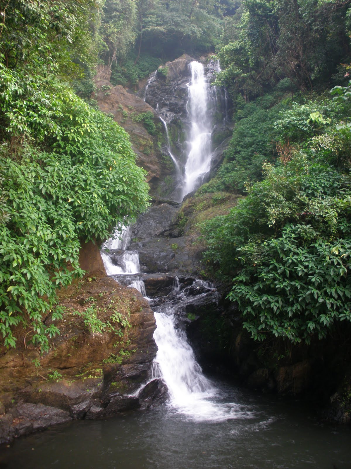
Purple line represents trek trail inside forest. This trek stretch  is most difficult part of your trek. You will find beautiful Hidlumane falls on the way. The best part is that  you trek beside the flowing water of Hidlumane falls but the stones are too slippery. This is a very beautiful stepped water falls. Don't come back thinking the first stream you get as the falls. Climb the rocks, if not possible take the alternative way through the forest. Go parallel to the stream, a huge, beautiful, ice cold water falls is waiting for you. ,
After the fall there is pretty steep climb inside forest. Length of this stretch is around 5 KMS. This trek rail reaches again jeep trail which is marked in blue line.
You need to trek on jeep road for another 2KMS to reach PWD guest house, This route is marked in blue line.  
3) Route -3 : Jeep route: This is longest trek route compared to other two . This trek trail is marked in Blue line. Total length of trek trail is around 15 KMS, This route will be  helpfull in heavy rain.
 All above routes 1, 2 and 3 takes you till PWD guest house. then there is a common path till peak. distance between kodachadri peak and PWD guest house is around 1.2KMS. 

Greenery all over except for the jeep tracks and a sheet of white clouds hovering above the head. For a minute , everything appears to be covered in white and then gradually as the clouds pass on , the greenery returns. Words aint enough to explain the experience  

Best time to visit Kodachadri is from October to February.

Monday, 9 January 2012

St.Mary's Island


St.Mary's Island
St. Mary's Island is located at a distance of 6 km from Udupi and 65 km north of Mangalore. St. Mary's Island is a collection of small islands in the Arabian Sea off the coast of Malpe in Udupi district.

It is said that in the year 1498, "Vasco Da Gama" landed on his voyage from Portugal to India and the name of one of these islands "El Padron de Santa MarĂ­a". This is how the islands have got their current name.
These islands are just rock projections arising out of the sea near Malpe. The St. Mary's Island beach is special for the unique formation of basalt rocks that have crystallized into whole columns and split into vertical hexagonal blocks.

The west coast of these islands is a haven of shellfish with shells of various shapes and sizes littered along the coast. The island is 300 m long and 100 m wide and has a few palm trees.

The only way to approach these islands is by boat. Regular boats ply from the Malpe Harbor to the islands. The frequency of these boats may vary depending on the amount of tourists.

Accommodations are not available at St. Mary's Island.But fresh fishes to eat are available.

Best season to visit: December-January


Distance from St. Mary's Island Beach
1. Udupi: 6 km
2. Mangalore: 65 km
3. Bangalore: 425 km


How to get there

Nearest Airport: Mangalore

Nearest Railhead: Udupi

Road: Udupi is well connected by roads. You need to catch another bus from Udupi to reach Malpe Fishing port. If you are going by your own vehicle take a left turn before Hotel Sarovar on NH17.

Thursday, 29 December 2011

Vibhuti Waterfalls


Vibhuti falls which is a beautiful waterfall about 30 Ft high and is a natural pool. vibhuti falls is located in Vibhuti Falls along the scenic banks of river Gangavali. Enter the gateway to the most unspoilt, untouched and unexplored exciting island by crossing the calm river through boat. Feel the heaven and tranquility surrounded in the crib of evergreen forests, majestic bamboo groves, landscaped garden and palm, impressive flora and fauna, magnificent rivers and natural scenic beauty
There is a big water falls of about 20 to 25 ft and a small one of 3ft .Some of us climbed to the top of the falls and it give a very good very of the surrounding area. This site is very good for camping and offers some mesmerizing sceneries down the valleys. We had a leisurely bath and unpacked our lunch and spent a couple of hours in the midst nature’s bounty. This river streams forms many such waterfalls on its way down the valley. 
 The place is a must watch for all nature lovers.


Reaching there
 By road:Take the road from Sirsi which goes to Mattighatta, Devanalli via Hegadekatta. You will not get a bus which takes you near the waterfall you will have to walk the Vaddi Ghat after you get down at Vaddi cross.
If you have your own vehicle pass the Vaddi Ghats and you need to take a deviation at a place called Mabagi which is about 3kms from the falls
Nearest Railway: Sirsi
Nearest Airport: Mangalore  Airport
Distance: From Bangalore 400 kms
                     From Mangalore 240 kms
                     From Sirsi 50 kms

Yana-Karnataka


This place in thickets of the Sahyadri hills of the Western Ghats is around 45kms from Sirsi and about the same distance from Kumta. Two huge rocks are the center of attraction here. There are two temples, temple of Shiva inside a cave and a Ganesha temple nearby. The other places of interest are a small waterfall and the forest itself.

There are two ways you can get there, Route (i) Take a bus from Sirsi which goes to mattighatta,devanalli via hegadekatta.Get down at a stop called "vaddi cross" and walk 6+kms from there. Route (ii) Take a bus either from sirsi or kumta get down at a place called Anegundi near Kathagaal. This place is after the Devimane ghats if you are coming from Sirsi. From here it is around 16kms walk.

Jeep is the best mode of transportation anywhere in North Kanara. You can hire a jeep either in sirsi or anywhere your base camp is and take convenient drives

Its better if you take the first route and leave Sirsi around 8am in the morning and have breakfast at Devanahalli and reach yana by 10am and if your time permits also visit Vibhuti Falls which is also near by.

Yana also has religious importance as mentioned in an event of Hindu mythology. It is believed that the demon king Bhasmasura performed penance to acquire a boon from Lord Shiva. As per the boon, whatever he touched burnt into ashes. Bhasmasura chased Lord Shiva in order to destroy him, who found refuge in the Bhairaweshwara peak at Yana.

Distance ...
From Bangalore 400+ kms
From Nearest Town 50 kms (sirsi)
From Nearest Petrol Bunk 50kms (sirsi, kumta)
Nearest Medical Help ~20kms (Hegadekatta)
Nearest Hotel ~50kms(Sirsi, Kumta

Friday, 2 September 2011

Hanuman gundi-Karnataka


Hanuman Gundi waterfalls is one of the main attractions near Kudremukh in Chikmagalur district.
Hanumangundi falls also called as Suthanabbi falls is located in the hilly region between Karkala and Lakya dam which is surrounded byKudremukh National Park.


The water falling down from a height of above 100 feet falling on the natural rocks majestically is exciting view.

You can have body rejuvenating and energizing bath at this place and enjoy the beauty of calm and marvel of the waterfall.

October to May is the best time to visit Hanuman Gundi Waterfalls. But during rainy season the waterfall has enchanting beauty but you are not allowed to take bath.


REACHING THERE:
It falls in Chikkamagalur district, and is in the heart of Kudremukh National Park. Taking your own vehicle would be a better option as the waterfall is in the interior region covered by forest which is one of the reasons for its beauty. It is about 30kms from Sringeri which is a major tourist spot. You get vehicles to the waterfall from this town. After reaching the waterfall you need to get down around 300 steps to reach the base where there lies a small rocky pond into which the water falls. The view is majestic and if the water is less, you can even take a rejuvenating bath. There are steps constructed by the forest department which are good enough for the usage. They charge you a nominal fee of Rs.20 as entrance which is worth for the beauty of the waterfall.There are no restaurants around and hence you need to pack your own food...